
Kaposszerdahely - Vue sur le village
Somogy County, Hungary — 66 km
Virje - Podravina, Croatia, West/North view
🇭🇷 Koprivnica-Križevci County · Croatia — Altitude 134 m
This live camera looks out over the flat, green countryside of Virje in northern Croatia, with its west and north outlook. It suits anyone curious about everyday life in Podravina or checking conditions before a trip to the region.
Virje is a small town in the Koprivnica-Križevci County, in the Podravina lowlands along the Drava River. The landscape is mostly fields, meadows and farmland, with little relief, so skies often dominate the scene. The region is known for agriculture, its river valley and a quiet, rural character far from the Adriatic coast. Virje sits at a modest altitude, and the area has a continental feel compared with the coastal south.
Depending on the view, you may see open fields, village rooftops, trees and the sky above the plain. Because the landscape is flat, weather changes are easy to follow: clouds building over the fields, morning mist lying on the lowlands, or sunsets across the horizon. Early morning and late afternoon usually give the most atmospheric light. Seasonal shifts are clearest here, from green summers to bare winter fields.
Podravina has warm summers and cold, often damp winters, so late spring through early autumn is generally the most pleasant time to visit. Virje is reached by road from Koprivnica and Varaždin, which are the nearest larger towns. Other cameras in the wider region are listed on this page, including views at Ptuj in Slovenia and Sljeme near Zagreb, which give a useful sense of the surrounding terrain.
Source: myearthcam.com
Somogy County, Hungary — 66 km

Somogy County, Hungary — 70 km
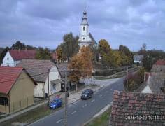
Somogy County, Hungary — 74 km

Zala County, Hungary — 80 km

Zala County, Hungary — 80 km

Zagreb, Croatia — 83 km

Zala County, Hungary — 87 km
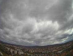
Zala County, Hungary — 87 km

Baranya County, Hungary — 89 km

Zala County, Hungary — 92 km
The current conditions and a 3-day forecast for Virje are shown in the live weather block on this page. The values update automatically, so you can check them before you look at the view.
The local time in Virje is shown in the live clock on this page. It follows the local time zone, so it stays correct even if you are viewing from another country.
The camera is in Virje, in the Koprivnica-Križevci County of northern Croatia, at about 134 metres above sea level. The map on this page shows its exact position in the Podravina region.
Early morning and late afternoon usually bring the most atmospheric light across the flat landscape. Clear days also make distant features and changing skies easier to see.
Partner links: we may earn a commission at no extra cost to you.