Meran I - Meran 2000 Piffing
Trentino-South Tyrol, Italy — 2 km
Meran I - Naifjoch Berg
🇮🇹 Trentino-South Tyrol · Italy
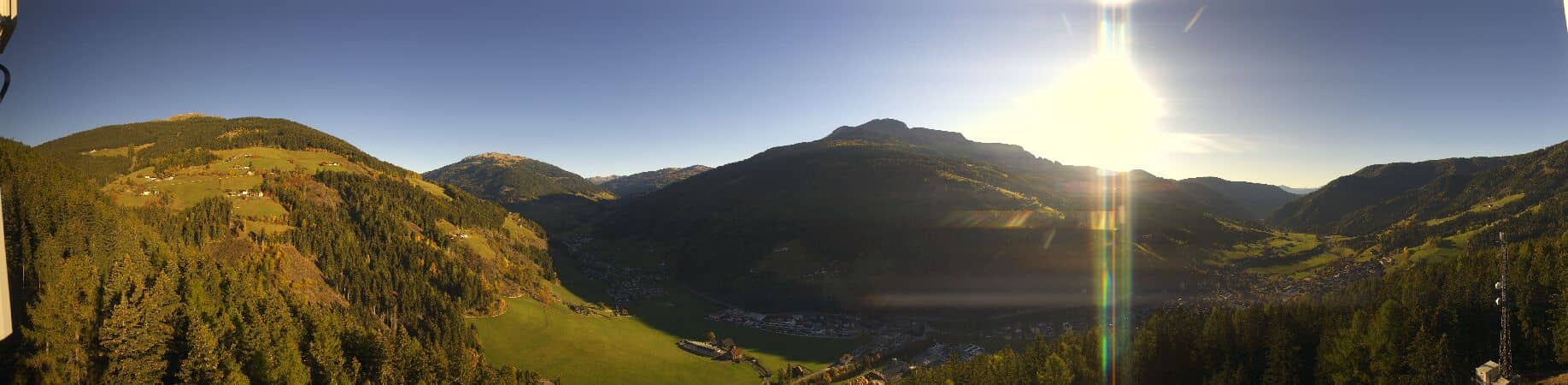
This camera looks out over the mountain country above Merano in South Tyrol, where the Naifjoch ridge marks the edge of the town's upland hiking terrain. It is useful for judging the sky and cloud cover over the valley before you head up into the hills. The live player, local time and weather forecast are all shown below the image.
Merano sits in a broad valley of the Adige river in the Italian province of South Tyrol, surrounded by steep mountain slopes. The town is known for its spa tradition from the nineteenth century, its promenades lined with palms and gardens, and its mix of Italian and German-speaking culture. The Naifjoch area rises above the town as a wooded and pastoral ridge, giving a sense of the transition from the valley floor to alpine terrain.
Because the view is dominated by mountain slopes and sky, the picture changes most with weather and light. Clear mornings often bring crisp outlines of the ridges, while afternoon clouds can build quickly over the peaks in summer. Late in the day the low sun can light the slopes warmly. Depending on the view, you may see forest, meadows and buildings on the lower hillsides, and snow on higher ground in colder months.
The region has a climate with warm summers and cold winters, and valley temperatures can be noticeably higher than on the surrounding peaks. Spring and early autumn are popular for walking, while winter brings snow to the higher slopes. Nearby on VizCams you can compare views from Meran 2000 Piffing, Saxifraga, Terme and the Ippodromo, all within about ten kilometres of this camera.
Visibility is the main thing to check before planning anything outdoors. Haze in the valley is common on warm days, and fog can settle in the mornings in autumn. The forecast below gives the next three days so you can judge whether the upper slopes are likely to be clear.
Source: feratel.com
Trentino-South Tyrol, Italy — 2 km
Trentino-South Tyrol, Italy — 7.3 km

Trentino-South Tyrol, Italy — 8.4 km
Trentino-South Tyrol, Italy — 8.6 km
Trentino-South Tyrol, Italy — 8.8 km
Trentino-South Tyrol, Italy — 10 km
Trentino-South Tyrol, Italy — 11 km
Trentino-South Tyrol, Italy — 12 km

Trentino-South Tyrol, Italy — 12 km

Trentino-South Tyrol, Italy — 13 km
The current conditions and three-day forecast for the Merano area are shown in the weather block on this page. They update with the page, so check there rather than relying on a fixed description.
The local time for Merano is shown on the page and follows the local clock of Italy, including daylight saving changes. The time block is updated live beside the camera.
The camera is located in the Merano area of South Tyrol, Italy, at approximately 46.69 north and 11.27 east. The map on the page shows its position and the surrounding terrain.
Clear mornings and late afternoons in good visibility tend to show the mountain outlines most clearly. Check the weather block before watching, since clouds and haze can hide the slopes for much of the day.
Partner links: we may earn a commission at no extra cost to you.