Sterzing - Skigebiet Rosskopf
Trentino-South Tyrol, Italy — 3.6 km
Sterzing - Wiesen - Pfitsch
🇮🇹 Trentino-South Tyrol · Italy
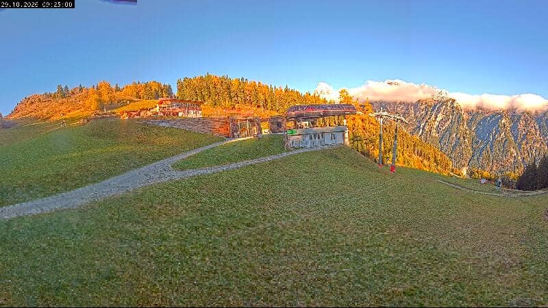
This live view looks across the meadows near Sterzing, the historic town in the Eisack valley of South Tyrol. It is a useful way to judge how the valley looks right now, from the greens of the grass to the cloud cover over the surrounding peaks. The page also shows local time and weather so you can plan a visit or simply keep an eye on the mountains.
Sterzing, known in Italian as Vipiteno, sits in the upper Eisack valley on the route toward the Brenner Pass. The old town has medieval arcades, painted façades and a main square that has been a trading point for centuries. The surrounding landscape is steep and wooded, with alpine pastures opening into broad meadows on the valley floor, and the Pfitsch valley branching off to the east. The area is bilingual, with German and Italian both widely spoken.
The title points to open meadows around the Pfitsch valley, so depending on the view you may see grassland, farm buildings, hedgerows and the slopes rising behind them. Mornings often bring clear air and sharp outlines on the peaks, while afternoons in summer can bring build-up of clouds over the ridges. Changes in light and weather are the most interesting thing to follow, since the scene itself changes little from hour to hour.
Sterzing has a mountain climate with warm summers and cold winters, and the nearby ski area draws visitors in winter. Late spring through early autumn is generally the most comfortable period for walking and cycling in the valleys. The town is easy to reach by road and rail along the Brenner corridor. Nearby cameras cover the Rosskopf ski area, the Pflerschtal valley and the Ladurns area near the Brenner.
Source: feratel.com
Trentino-South Tyrol, Italy — 3.6 km
Trentino-South Tyrol, Italy — 4.4 km
Trentino-South Tyrol, Italy — 4.6 km
Trentino-South Tyrol, Italy — 6.9 km
Trentino-South Tyrol, Italy — 10 km
Trentino-South Tyrol, Italy — 11 km
Tyrol, Austria — 11 km
Trentino-South Tyrol, Italy — 12 km
Tyrol, Austria — 17 km
Tyrol, Austria — 18 km
The current conditions and a three-day forecast for Sterzing are shown in the weather block on this page. They update with the live data, so you can check before deciding whether to head out.
The local time for Sterzing is displayed on this page and follows the local clock, including daylight saving changes. It is shown in the time block above the camera.
The camera is in the Sterzing area of the Eisack valley in South Tyrol, Italy, at roughly 46.90 N, 11.44 E. The map on this page shows its position relative to the town and the surrounding valleys.
Clear mornings tend to give the sharpest view of the peaks, while summer afternoons often bring clouds over the ridges. The view is most useful for checking conditions on days when you plan to be outdoors in the valley.
Partner links: we may earn a commission at no extra cost to you.