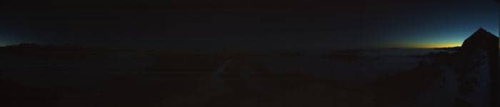
Sörenberg - Sommet du Brienzer Rothorn
Lucerne, Switzerland — 0 km
Sörenberg - Brienzer Rothorn - Gipfelrestaurant
🇨🇭 Lucerne · Switzerland
This live camera looks out from the summit restaurant on the Brienzer Rothorn, above the Sörenberg resort in the canton of Lucerne. It is a useful way to check how the mountain looks before you ride the cable car up. The page also gives you the local time and the current weather for the area.
Sörenberg is a small alpine village in the Entlebuch region of central Switzerland, known for its quiet valley setting and as a base for hiking and mountain biking. The Brienzer Rothorn rises above it as one of the best-known viewpoints in the area. The mountain sits within the Emmental Alps, where grassy slopes, forest and rocky ridges give the landscape its character.
The view from a mountain restaurant changes with the weather, the time of day and the season. Mornings often bring clearer air and softer light on the peaks, while afternoon cloud can build quickly over the ridges. Watching in winter can show snow cover, and in summer you may see the mountain greener and busier with visitors. Conditions shown on the stream are the best guide to what is actually visible.
Sörenberg is reachable by road and by public transport from Lucerne and Bern, and the Rothorn cable car is the usual way to the summit. The area is at its most popular in summer for hiking and in winter for skiing and snowshoeing. Nearby cameras on VizCams include the Sörenberg Rothorn Eisee and Rossweid views, which can help you compare conditions at different heights.
Source: feratel.com
Lucerne, Switzerland — 0 km

Bern, Switzerland — 0.2 km
Lucerne, Switzerland — 1.4 km
Lucerne, Switzerland — 2.7 km
Lucerne, Switzerland — 4.4 km
Lucerne, Switzerland — 5.2 km

Bern, Switzerland — 8.6 km

Bern, Switzerland — 11 km

Lucerne, Switzerland — 12 km

Bern, Switzerland — 13 km
The current weather for Sörenberg and a three-day forecast are shown on this page, updated alongside the live view. Mountain conditions can differ a lot from the valley, so check the forecast before going up.
The local time for Sörenberg is displayed on this page, based on Swiss time. It updates automatically so you can plan your visit or call.
The camera is at the summit restaurant on the Brienzer Rothorn above Sörenberg in the canton of Lucerne, at about 46.79 degrees north and 8.04 degrees east. The map on this page shows its position.
Clear mornings tend to give the sharpest views of the surrounding peaks, while winter can show snow and summer shows the green slopes. Weather decides a lot, so watch at different times of day to see what suits you.
Partner links: we may earn a commission at no extra cost to you.