
São Roque - Catarina Aeroporto Executivo - Sudeste
São Paulo, Brazil — 0.1 km

São Roque - Catarina Aeroporto Executivo - Sudoeste
🇧🇷 São Paulo · Brazil — Altitude 742 m
This live stream looks out over Catarina Executive Airport in São Roque, a small general aviation field in the countryside west of São Paulo. It suits anyone curious about light aircraft activity, rural weather in the Brazilian interior, or simply what a quiet airstrip looks like through the day.
São Roque is a town in the state of São Paulo, set on a plateau at roughly 740 metres above sea level. The area is known for its wine country and rolling hills, and it lies within easy reach of the state capital. The airport serves private and executive flights, which keeps the field calm compared with commercial hubs, and the surrounding landscape is mostly farmland and patches of native vegetation.
The camera shows the airfield from the southwest, so the view depends on where the aircraft and runway sit in frame. Activity is usually heaviest in the morning and late afternoon, when pilots prefer cooler and smoother air. Cloud build-up over the hills is common in the warmer months and can change the look of the sky quickly, so the picture is worth checking at different times of day.
The local climate is subtropical at altitude, with mild temperatures, a wet summer from roughly October to March and drier, cooler winters. The dry season is generally the most comfortable for visiting the region. The nearby Itu and Sorocaba area also has cameras on this site, which you can open from the list below to compare conditions a short drive away.
Source: climaaovivo.com.br
São Paulo, Brazil — 0.1 km

São Paulo, Brazil — 19 km

São Paulo, Brazil — 19 km
São Paulo, Brazil — 28 km

São Paulo, Brazil — 31 km
São Paulo, Brazil — 31 km
São Paulo, Brazil — 39 km
São Paulo, Brazil — 42 km

São Paulo, Brazil — 52 km
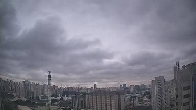
São Paulo, Brazil — 53 km
The current conditions and a three-day forecast for São Roque are shown in the live weather block on this page. They update automatically, so you can check them alongside the camera view.
The local time in São Roque is displayed on this page and follows Brazil's time zone for São Paulo state. It is shown live next to the camera.
The camera is at Catarina Executive Airport on the edge of São Roque, in the state of São Paulo. The map on this page marks its position, and the coordinates are listed there.
Mornings and late afternoons tend to show the most aircraft movement, while the clearest skies are usually in the drier months. Conditions vary, so checking at different times gives the best picture.
Partner links: we may earn a commission at no extra cost to you.