Elm - Munggä Hüttä
Glarus, Switzerland — 0.9 km
Elm - Ämpächli
🇨🇭 Glarus · Switzerland
This live camera looks out over Elm, a village in the Glarus Alps of eastern Switzerland. Use it to check mountain conditions and cloud cover before a walk, or simply to see how the valley looks right now. The page also shows local time and the weather forecast for Elm.
Elm lies in the Sernf valley of canton Glarus, surrounded by steep limestone and slate peaks. It is a quiet alpine village known for its access to hiking routes, the Glarus Alps and the Sernftal landscape. The area has a long tradition of farming and alpine life, and its valleys are shaped by rivers and glaciers from the last ice age.
The title names the Ämpächli area, so the view is likely of the village and the surrounding slopes, though the exact frame depends on the camera position. Mornings often bring clear light on the peaks, while afternoon clouds can build over the ridges. Watching during changing weather is a good way to judge whether a hike is worth attempting.
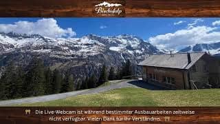
Elm has a mountain climate with cool summers and snowy winters, and conditions can change quickly between valley and summit. Late June to September is usually the most comfortable season for hiking. Nearby cameras on this site include Munggä Hüttä, Schabell and the Bischofalp mountain hotel view, which can help you compare conditions at different heights.
Source: feratel.com
Glarus, Switzerland — 0.9 km
Glarus, Switzerland — 1.1 km
Glarus, Switzerland — 1.4 km
Graubünden, Switzerland — 5.9 km

Graubünden, Switzerland — 8.1 km

Graubünden, Switzerland — 8.8 km

Graubünden, Switzerland — 8.9 km

Graubünden, Switzerland — 8.9 km

Graubünden, Switzerland — 9 km
Graubünden, Switzerland — 11 km
The current weather and a 3-day forecast for Elm are shown in the live block on this page. Conditions in the mountains can change quickly, so check it before you set out.
The local time in Elm is displayed on this page and follows Swiss time. It updates live alongside the camera view.
The camera is located in Elm in the canton of Glarus, Switzerland, at roughly 46.92 north and 9.16 east. A map on the page shows its position in the valley.
Clear mornings and periods after rain are often the most interesting, when the peaks are visible and the light is sharp. Check the live view to see what the weather is doing before planning a walk.
Partner links: we may earn a commission at no extra cost to you.