
Arosa - Brüggerhorn
Graubünden, Switzerland — 1.1 km

Arosa - Weisshorn
🇨🇭 Graubünden · Switzerland — Altitude 2650 m
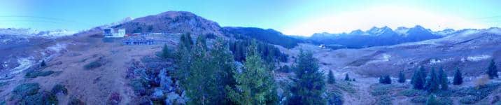
This live camera looks toward the Weisshorn from the Arosa area in the Swiss Alps, at an altitude of about 2,650 metres. It is useful for anyone checking whether the peaks are clear before planning a hike, a ski day or a drive over the pass. The stream is shown here with its local time and weather so you can judge conditions at a glance.
Arosa sits in the Schanfigg valley of the canton of Graubünden, reached by a winding road from Chur. It is a village known for its mountain air, its forests and its ring of peaks, and it has grown into a year-round base for walkers, skiers and families. The Weisshorn is one of the striking summits in the surrounding range, and the surrounding high country gives the area a quiet, open character that changes noticeably with the seasons.
The title names the Weisshorn, so the frame is built around that mountain and its slopes rather than the village streets. Clear mornings tend to give the sharpest light on the rock faces, while afternoons often bring cloud build-up over the ridges. In winter, snow changes the colours of the slopes entirely, and in summer the green meadows contrast with the grey summit. Conditions can shift quickly in the mountains, so the live stream is most useful when checked shortly before you go out.
Summers are mild and walking season usually runs from June to October, while winter brings reliable snow for skiing from December into spring. Arosa is reached by car or by the regional train line from Chur, and getting around the village is easy on foot. Nearby cameras on this site, including Brüggerhorn, Bärenland, Tschuggen and the view from Hôtel Hof Maran, cover other parts of the same area and are worth comparing before you decide where to go.
Source: roundshot.com
Graubünden, Switzerland — 1.1 km
Graubünden, Switzerland — 2.1 km

Graubünden, Switzerland — 2.1 km

Graubünden, Switzerland — 3.4 km

Graubünden, Switzerland — 3.5 km

Graubünden, Switzerland — 3.9 km

Graubünden, Switzerland — 6 km

Graubünden, Switzerland — 6.6 km

Graubünden, Switzerland — 6.9 km

Graubünden, Switzerland — 8.2 km
The current conditions and the three-day forecast for the Arosa area are shown on this page next to the live view. Mountain weather can change within hours, so check the figures just before you set out.
The local time for Arosa is displayed on the page above the stream. Switzerland follows Central European Time with daylight saving in summer.
The camera is in the Arosa area of Graubünden, Switzerland, at an altitude of roughly 2,650 metres, pointed toward the Weisshorn. A map on the page shows its position relative to the village.
Clear mornings often give the most detail on the summit, and the season changes the scene a great deal, with snow in winter and green slopes in summer. Check the weather block first to see whether the peak is likely to be visible.
Partner links: we may earn a commission at no extra cost to you.