
Lenzerheide - Urdenfuerggli
Graubünden, Switzerland — 3 km

🇨🇭 Graubünden · Switzerland — Altitude 2865 m
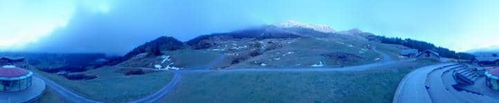
This camera looks out from the Parpaner Rothorn, a mountain above the Lenzerheide resort in the Swiss canton of Graubünden. It is useful for checking alpine conditions, cloud cover and snow before heading up into the Lenzerheide ski and hiking area.
Lenzerheide sits in the Albula valley of eastern Switzerland, at about 1,470 metres, surrounded by forested slopes and high alpine ridges. The Parpaner Rothorn rises to around 2,865 metres above it and is part of the wider Lenzerheide ski region. The village is known as a year-round base for mountain sport, and its lakeside setting on the Heidsee gives the valley a calm contrast to the peaks above.
Because the camera is set high on a summit, the view is mostly about the mountain environment: ridges, slopes, sky and weather moving across the Graubünden Alps. Depending on the season you may see snow cover, green summer meadows or clouds building in the afternoon. Mornings often bring the clearest skies, while changing light in the late afternoon can show the relief of the peaks particularly well.
Summers are mild and good for hiking, while winters bring reliable snow for skiing. Shoulder seasons can be unsettled at altitude, so check the live weather block before you travel. Nearby cameras include Urdenfuerggli, Station aval, Heimberg in Parpan and Bargias at Heidsee, which can help you compare conditions across the valley.
Conditions at 2,865 metres can differ sharply from the village below, so the view is a good first check. Visibility may drop quickly in cloud or fog, and wind can be strong on exposed ridges. Use the local time and weather information on this page to plan your day around the light and the forecast.
Source: roundshot.com
Graubünden, Switzerland — 3 km

Graubünden, Switzerland — 3.1 km

Graubünden, Switzerland — 3.2 km

Graubünden, Switzerland — 3.9 km
Graubünden, Switzerland — 5.1 km

Graubünden, Switzerland — 5.6 km

Graubünden, Switzerland — 6 km

Graubünden, Switzerland — 6.4 km

Graubünden, Switzerland — 6.8 km

Graubünden, Switzerland — 7 km
The current conditions and a 3-day forecast for Lenzerheide are shown in the live weather block on this page. They update automatically so you can compare them with what the camera shows.
The local time for Lenzerheide in Switzerland is displayed on this page and follows the local clock, including daylight saving changes.
The camera is on the Parpaner Rothorn above the Lenzerheide resort in the canton of Graubünden, at about 2,865 metres altitude. The map on this page shows its position.
Morning often gives the clearest views, while late afternoon light can bring out the shape of the peaks. Check the weather block first, since cloud can hide the view for long periods.
Partner links: we may earn a commission at no extra cost to you.