Snoqualmie
Washington, United States — 4.1 km
🇺🇸 Washington · United States — Altitude 953 m
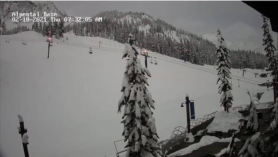
This live camera looks across the mid-mountain slopes of Alpental, a ski area in the Snoqualmie Pass corridor of the Washington Cascades. It is useful for checking how much cloud, snow or wind is sitting on the upper terrain before you drive up the pass. The stream is provided by its owner and embedded here with a link to the source.
Alpental sits in King County about an hour east of Seattle, on the western side of Snoqualmie Pass at roughly 950 metres above sea level. The area is part of the Cascade Range, a chain of volcanic peaks known for deep winter snowpack, dense conifer forest and steep alpine terrain. Its reputation rests mainly on skiing and snowboarding, and the surrounding landscape changes sharply with elevation, from wet lowland forest to bare rock and snowfields above the treeline.
The view is aimed at the mid-mountain part of the ski area, so the most useful information is about snow cover, visibility and cloud height rather than distant scenery. Depending on the view, you may see fresh snow after overnight storms, grooming activity in the early morning, or fog rolling through the trees in mild, wet weather. Clear mornings after a storm tend to be the most rewarding moments to watch.
The Cascades get heavy precipitation from October through April, and the pass is often affected by chains requirements and sudden closures after snowfall. Late January through March usually offers the deepest snow, while late summer is dry and warm at the lower elevations. Nearby cameras at Snoqualmie, the Silver Fir base area and Skykomish give a fuller picture of conditions along the pass and the road to the mountains.
Source: CamStreamer
Washington, United States — 4.1 km
Washington, United States — 5 km
Washington, United States — 30 km

Washington, United States — 57 km
Washington, United States — 58 km
Washington, United States — 58 km
Washington, United States — 61 km
Washington, United States — 66 km
Washington, United States — 70 km
Washington, United States — 70 km
The current conditions and the three-day forecast for this location are shown in the live weather block on this page. They update automatically, so you can check temperature, wind and precipitation before you travel.
The local time for the camera's location is displayed on the page and updates in real time. It follows Pacific time, the time zone used across Washington State.
The camera is on the mid-mountain slopes of Alpental in King County, Washington, at about 950 metres elevation. The map on this page shows its position on the Snoqualmie Pass side of the Cascades.
Winter mornings after fresh snowfall are often the most interesting, when the slopes are being groomed and visibility can change quickly. Watching during a storm also shows how quickly conditions shift at this elevation.
Partner links: we may earn a commission at no extra cost to you.