Morgantown
West Virginia, United States — 45 km
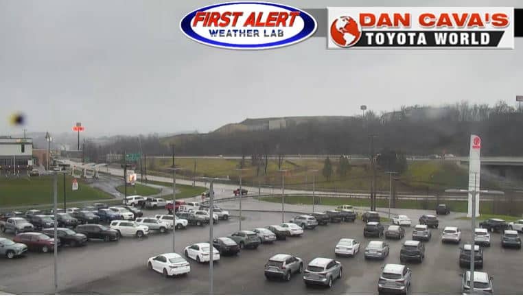
Bridgeport
🇺🇸 West Virginia · United States — Altitude 309 m
This live view covers Bridgeport, a small town in north-central West Virginia on the West Fork River. The embedded stream lets you check conditions here as they happen, without a visit. It suits anyone planning a trip through the Mountain State or following the local weather.
Bridgeport sits in Harrison County, in the hills of north-central West Virginia, where the Appalachian ridges give way to river valleys. The town grew around river and rail traffic and is close to Clarksburg and the larger city of Morgantown. The surrounding country is wooded and rolling, with farmland in the valleys and a strong sense of small-town life along the main roads.
The live picture shows the town as seen from its camera position, and the view changes noticeably with the light. Mornings often bring mist in the valley, while late afternoon light brings out the colour of the trees. In autumn the hillsides turn deep red and gold, and in winter snow and bare branches change the look entirely. Depending on the view, you may also notice traffic and river conditions.
Bridgeport has a humid continental climate with warm, humid summers and cold winters that bring snow and frost. Spring and autumn are generally the most pleasant times to visit. Interstate 79 runs nearby, making the town easy to reach by car. Nearby cameras in the region include Morgantown, the Westover docks view and a Monongahela River view further north.
Source: Bridgeport Webcam
West Virginia, United States — 45 km

West Virginia, United States — 45 km

Pennsylvania, United States — 76 km

West Virginia, United States — 77 km
West Virginia, United States — 78 km
West Virginia, United States — 81 km
West Virginia, United States — 81 km

Maryland, United States — 83 km

Maryland, United States — 83 km

Maryland, United States — 83 km
The current conditions and a three-day forecast for Bridgeport are shown in the weather block on this page, updated automatically. Check it before heading out, as conditions in the hills can change quickly.
The local time for Bridgeport is shown on this page and follows Eastern Time, including daylight saving changes. The clock updates live alongside the camera.
The camera is located in Bridgeport, West Virginia, at roughly 39.31 north and 80.28 west, at an elevation of about 309 metres. The map on this page marks its position in the town.
Daylight hours give the clearest picture, and early morning or late afternoon light is most atmospheric. Autumn is especially striking because of the colours on the surrounding hills.
Partner links: we may earn a commission at no extra cost to you.