
Dana Point - Monarch Bay Beach Club
California, United States — 0.8 km
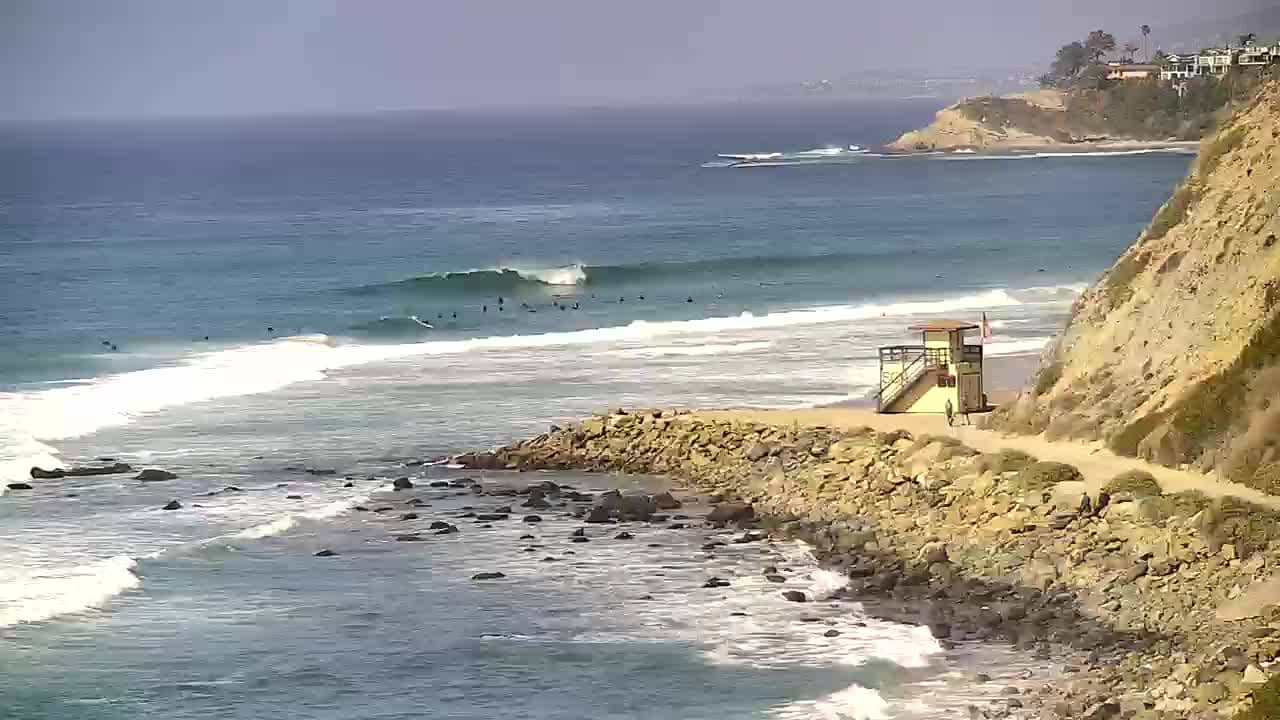
Dana Point - Salt Creek Beach
🇺🇸 California · United States — Altitude 3 m
This live camera looks out over Salt Creek Beach in Dana Point, on the Orange County coast of Southern California. It is a useful way to check surf and beach conditions before deciding whether to drive down. The page also shows local time and the current weather with a short forecast.
Dana Point is a harbor town on the coast south of Los Angeles, known for its marina, bluffs and sheltered coves. Salt Creek Beach sits below the headlands and is popular with surfers and families alike. The mix of rocky points, sand and open ocean gives the area a relaxed coastal character that changes with the tide and swell.
Depending on the view, you may see waves breaking along the beach, surfers in the water and the level of sand at different tides. Mornings often bring calmer water before the afternoon breeze picks up. Watching during a weekend morning or a day with a strong swell can show the most activity, while a flat day offers a quieter view of the shoreline.
Southern California has mild, dry summers and winters that are cool but rarely cold, so the coast is pleasant most of the year. Late spring through early fall is generally the most comfortable time for a beach visit. Nearby, the Monarch Bay Beach Club and Monarch Beach Golf Links cameras cover the same stretch of coast, and the Dana Point Harbor camera shows the marina a short drive away.
Source: thesurfersview.com
California, United States — 0.8 km

California, United States — 0.9 km

California, United States — 2.2 km
California, United States — 6.1 km
California, United States — 10 km
California, United States — 16 km
California, United States — 42 km
California, United States — 44 km

California, United States — 44 km
California, United States — 54 km
The current conditions and a three-day forecast for Dana Point are shown in the weather block on this page, updated with the live view.
The local time for Dana Point is displayed on this page and follows the Pacific time zone used across California.
The camera is located on the coast of Dana Point in Orange County, California, and the map on this page marks its position.
Weekend mornings and days with a clear swell are often the most lively, while calm weather gives a quieter view of the shoreline.
Partner links: we may earn a commission at no extra cost to you.