
Rattenberg - Zierling
Bavaria, Germany — 6.1 km
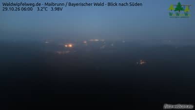
Maibrunn - Sentier des cimes Waldwipfelweg - Forêt de Bavière - vue vers le sud
🇩🇪 Bavaria · Germany — Altitude 850 m
This live camera looks out over the Bavarian Forest near Maibrunn, facing south from the Treetop Path, a walkway built among the crowns of the trees. It is a useful way to check how the forest looks right now before planning a visit. The page also shows local time and the weather for the area.
Maibrunn is a small village in Bavaria, Germany, in the wooded uplands of the Bavarian Forest, a low mountain range along the Czech border. The area is known for dense spruce, beech and fir woodland, quiet valleys and long hiking routes. At roughly 850 metres above sea level, the landscape feels open and cool compared with the lowlands to the north and east.
The camera is listed under nature and faces south, so the view is mainly of forest canopy and the land falling away into the distance. Depending on the weather, you may see layers of hills, mist in the valleys or changing light through the trees. Early mornings and late afternoons often show the most contrast, and autumn brings colour to the broadleaf trees, while winter may bring snow across the treetops.
The Bavarian Forest has cold winters with frequent snow and mild, showery summers, so late spring through early autumn is the most popular period for walking. Maibrunn lies within reach of several other cameras in the region, including Rattenberg, Drachselsried and Bad Kötzting, which can help you compare conditions across the area. Check the live weather on this page before you set out.
Source: foto-webcam.eu
Bavaria, Germany — 6.1 km
Bavaria, Germany — 8.7 km
Bavaria, Germany — 19 km
Bavaria, Germany — 19 km

Bavaria, Germany — 21 km
Bavaria, Germany — 23 km
Bavaria, Germany — 24 km
Bavaria, Germany — 26 km
Bavaria, Germany — 27 km

Bavaria, Germany — 28 km
The current conditions and a 3-day forecast for Maibrunn are shown in the live weather block on this page. The figures update automatically, so you can check them before deciding on a walk.
The local time in Maibrunn is displayed on this page and follows the local time zone of Germany. It is shown live next to the camera.
The camera is placed on the Treetop Path near Maibrunn in Bavaria, at about 850 metres altitude. A map on this page marks its position and the surrounding area.
Morning and late afternoon usually give the clearest light and the best contrast in the forest. Autumn colours and winter snow are also popular times, depending on conditions on the day.
Partner links: we may earn a commission at no extra cost to you.